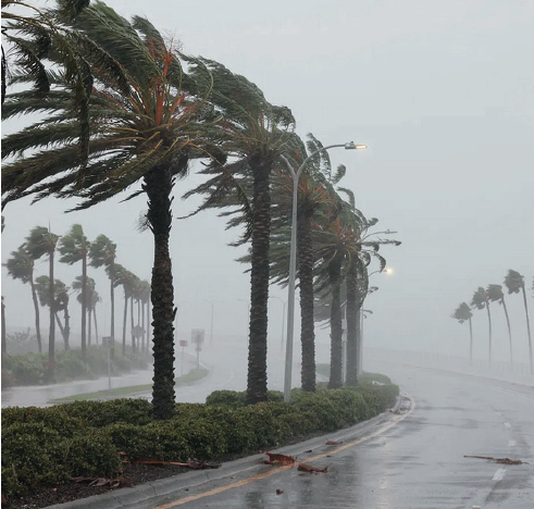
Longboat and Sarasota residents were battered with a deluge of storm modeling, unfavorable tracking predictions and worst-case scenarios throughout the day on Friday as Tropical Storm Debby approached.
The National Hurricane Center said the Tropical Cyclone 4 will likely develop into Tropical Storm Debby on Saturday, and placed both Sarasota and Manatee Counties under a Tropical Storm Watch. The prediction by Friday evening is that starting on Saturday night, more than four to eight inches of rain would arrive, with a storm surge of one to three feet. Manatee County opened a shelter, but there were no evacuations on Friday.
Sarasota County said its public work crews have been busy clearing drains as well as the beaches of lifeguard stands and other objects.
The tropical storm moved across Cuba on Friday, heading over the Straits of Florida, the channel separating the Florida Keys and Cuba. The National Hurricane Center predicted that Tropical Cyclone 4 would grow into Tropical Storm Debby on Saturday when its sustained winds exceed 39 mph. If it reaches 74 mph, it becomes a named hurricane.
Several meteorologists have warned that the extremely warm temperatures in the Gulf of Mexico could lead to the rapid intensification of the storm. If the warm temperature is met with low wind shear, it could more than double in intensity within 24 hours.
For most Longboaters and Sarasota residents, the likely dangers are two-fold: falling limbs and flooded roads. Many in the area remember just two months ago when St. Armands Circle lay more than two feet under water and dozens of cars were stranded after several inches of rain fell within three hours.
